
“Soil maps” project completed
Maps of soil properties and functions have been created in three study areas with the help of digital soil mapping.
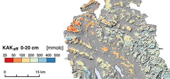
Data from soil mapping, soil monitoring programmes and soil pressure studies can be used to create maps of soil properties. For this purpose, soil data are linked to selected environmental variables. These variables characterise the factors that have influenced soil formation (climate, topography, geology and land usage). Soil properties for any given point can be predicted from the statistical relationships between soil data and environmental variables. Assessment rules can then be used to derive maps of soil functions. These show where and to what extent soils can perform their functions. They are an important basis for using soil sustainably and taking account of its qualities in spatial planning.